Twelfth State Line and Much Climbing
Twelfth State Line and Much Climbing
Wednesday 26th June, 2019
Day 47
Temp: 63 - 85 F sunny
Dew point: 61 F
Winds: calm
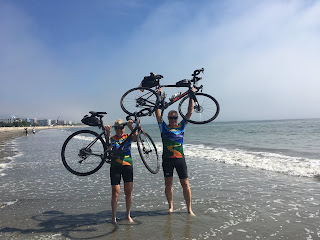
Tomorrow is our last full day of riding. And then Friday is our dip day in the Atlantic Ocean. This trip went much too quickly but is a consequence of a full schedule everyday.
Wednesday 26th June, 2019
Day 47
Location:
Troy, NY to Brattleboro, VT
Distance:
74 miles.Temp: 63 - 85 F sunny
Dew point: 61 F
Winds: calm
Cumulative climbing distance: 5,410 ft (1+ mile)
Cumulative descending distance: 5,066 ft
Well so much for another mechanical-free
day. Woke up this morning with another
flat rear tire. The tally is now Ken 12
and Judi 5.
Crossed our 12th
state line today and entered our 13th state – Vermont.
Today was all about climbing and descending, as
the today’s route had the 2nd most climbing distance of the entire
trip. Hard to believe but an interesting
consequence of the route. We started in
Troy, NY on the Hudson River (elevation 29 ft) and then climbed over 2 separate
mountain ridges (elevation 2371 and 2153 ft) on Vermont route 9, which runs
east-west across the southern portion of the state. We ended the day in Brattleboro (elevation
288 ft), which is on the Connecticut River and the eastern state line.
Tomorrow is our last full day of riding. And then Friday is our dip day in the Atlantic Ocean. This trip went much too quickly but is a consequence of a full schedule everyday.
Unfortunately one of our riders crashed today
on a steep descend and had to be airlifted to a
hospital. We are still waiting to learn
the extent of his injuries and the details of the crash, as none of the other
riders witnessed the crash. Quiet dinner today, as this could easily been any one of us.
Everyone is now being extra caution to ensure a safe ending.
The Vermont mountains are called the Green Mountains for obvious reasons.
Numerous moose crossing signs.
Have seen wind turbines in every state during this trip.
These grades make for both challenging climbs and descents.
At the summit pass for Hogback Mountain.
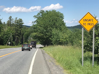
The descent on this highway was challenging (scary) due to cars passing us a 60 mph while we biked on a rough, narrow to no shoulder highway.


Getting to the end if your trip, and the end of your blog.
ReplyDeleteBe safe you guys!